Five facts explain the Gold Coast better than its familiar holiday image:
- It is Queensland’s second-largest city after Brisbane.
- More than 70 kilometres of beach form its Pacific edge.
- The Gold Coast Broadwater sits within a network of natural and altered waterways.
- Surfing helped shape the identity of coastal districts such as Surfers Paradise and Burleigh Heads.
- Rainforest-covered highlands rise behind the developed coastal plain.
Together, these facts reveal a large and varied city. The Gold Coast is neither one long resort nor a completely man-made place. Urban growth transformed much of the coastal plain, but development took shape around natural beaches, headlands, islands, waterways and forested ranges.
1. How did the Gold Coast become Queensland’s second-largest city?
The Gold Coast is Queensland’s second-largest city after Brisbane. That fact can surprise people who picture it as a narrow holiday strip centred on Surfers Paradise. Understanding the city's scale helps visitors prioritize their must-do activities. must-do activities
The city occupies a large part of South East Queensland. Its urban area contains business districts, established suburbs, residential towers, industrial areas and quieter coastal neighbourhoods. Tourism remains highly visible, yet the Gold Coast also functions as a home, workplace and service centre for a large population.
This scale changes how the city should be understood. Surfers Paradise is one district within the Gold Coast, not another name for the whole city. Southport serves as a major commercial and civic centre. Other parts of the city have their own shopping areas, schools, workplaces and community spaces.
The Gold Coast therefore has no single centre that explains everything around it. A map may show a dense coastal line, but that line contains several distinct centres. Their character changes as you travel north or south.
Southport feels different from Surfers Paradise. Burleigh Heads combines a coastal village feel with a busy urban setting. Mermaid Beach is more residential, despite sitting close to major visitor areas. Inland suburbs can feel removed from the towers even when the ocean is only a short drive away.
This spread helps explain why journeys across the Gold Coast can take longer than first-time visitors expect. Two places described as being “on the Gold Coast” may sit in separate districts with different roads, beaches and commercial hubs between them.
The useful distinction is between the City of Gold Coast, the wider visitor destination and the individual neighbourhoods within it. Treating them as the same place hides the city’s true size. When reading a map, start with the district name rather than assuming every address sits near Surfers Paradise.
2. What does a coastline of more than 70 kilometres look like?
The Gold Coast has more than 70 kilometres of coastline facing the Pacific Ocean. Its famous sand is part of a long coastal system rather than one continuous beach with the same conditions everywhere.
The ocean edge includes open beaches, creek mouths, headlands and neighbourhoods built close to the sand. This length allows many parts of the city to have a direct relationship with the sea. Beach access, weather, surf conditions and coastal erosion affect daily life far beyond the main visitor precincts.
Surfers Paradise provides the most recognisable view: a broad beach backed by tall buildings. That scene represents one section of the coast. Burleigh Heads has a prominent headland and a more enclosed visual setting. Mermaid Beach has lower-rise residential streets near the shore. Other stretches feel busier, quieter or more exposed according to their position and surrounding development.
The coastline also helps explain the Gold Coast’s unusual urban shape. Much of the city extends along a north-to-south corridor between the ocean and the inland ranges. Roads, neighbourhoods and commercial areas follow that long form. People often move along the coast rather than towards one central point.
A long beachfront does not mean every section offers the same swimming or surfing conditions. Waves, currents, creek entrances and weather can change what is safe or suitable. A calm-looking patch of water may still carry a strong current. Patrolled areas and beach safety signs matter more than the reputation of the suburb.
The coast is also a chain of local places. Residents may identify closely with one beach even when another lies nearby. Each area develops its own walking routes, gathering spots and rhythm around access to the sand.
The most useful way to understand this fact is to compare settings rather than rank beaches. Look at what sits behind the sand, whether a headland changes the view and how exposed the shore is to the Pacific. This reveals far more than a single postcard from Surfers Paradise.
3. Is the Gold Coast really a man-made city?
No. Calling the entire Gold Coast man-made confuses heavy urban engineering with the natural geography beneath it. The modern city contains planned estates, canals, altered drainage and reclaimed or reshaped land. Its beaches, ocean, headlands, islands and original waterways were not created as one giant development project.
The Gold Coast Broadwater makes this distinction easier to see. It is a sheltered body of water lying between the mainland and coastal islands, including South Stradbroke Island. Its setting differs from the open Pacific beaches nearby. Boats, channels, tidal movement and protected shorelines give the northern Gold Coast another kind of coastal character.
Development changed how people live around this water. Canal estates extended waterfront housing inland. Bridges connected neighbourhoods across creeks and channels. Seawalls, marinas and roads reshaped parts of the shore. These works produced an urban pattern that can look planned from above, especially where rows of homes follow branching canals.
Yet natural features still control the broad structure. The Pacific Ocean forms the eastern edge. Islands shelter parts of the Broadwater. Rivers and creeks connect inland catchments with the coast. Sand movement and tides continue to affect entrances and shorelines. Engineering works within this system rather than replacing it.
This fact matters because the “man-made city” label removes the relationship between development and nature. The more accurate story is about a city that grew rapidly across a sensitive coastal plain. Water influenced where people built, while construction changed how many waterways now look and function.
The contrast becomes clear on a map. Straight roads and regular housing blocks meet winding channels, islands and the curved ocean shore. Some canal branches show obvious planning. The Broadwater and South Stradbroke Island reveal the larger coastal setting around those projects.
Viewing the Gold Coast from the water can make this pattern easier to read. Towers, marinas and canal homes sit beside tidal channels and island vegetation. The interesting fact is not that people made the whole city. It is that planned development became tightly interlocked with an existing coastal system.
4. How did surfing shape the city’s identity?
Surfing shaped the names, public image and daily culture of the Gold Coast. It is more than an activity sold to visitors. The ocean affects how coastal areas look, how people use public space and how several districts present themselves.
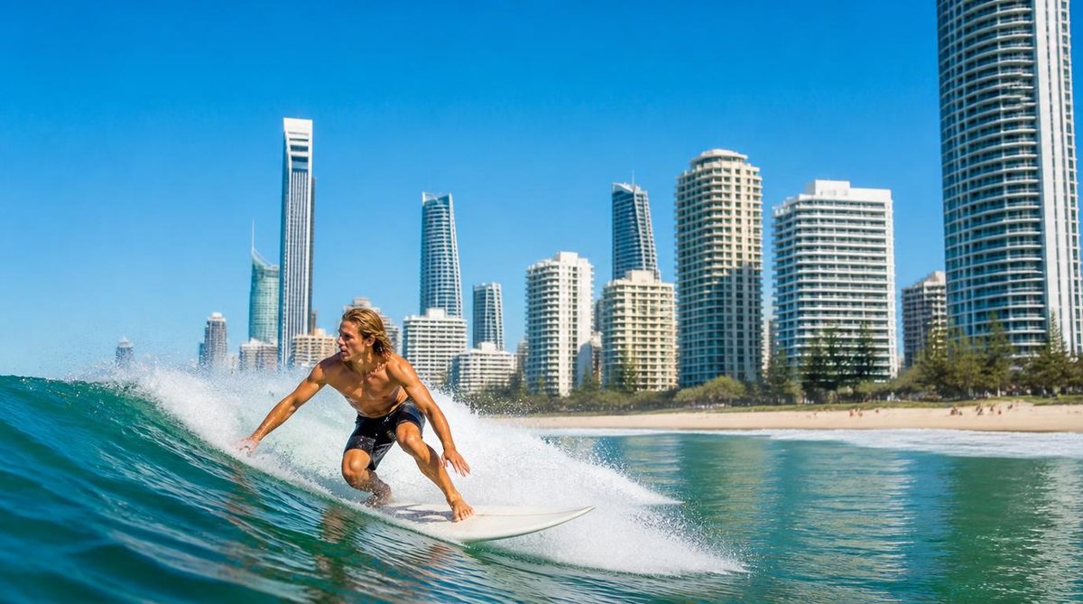
Surfers Paradise offers the clearest example in its name. The district became closely linked with the image of sun, sand and an active beach life. Its skyline later added a strong urban element, creating the familiar sight of towers rising behind the surf.
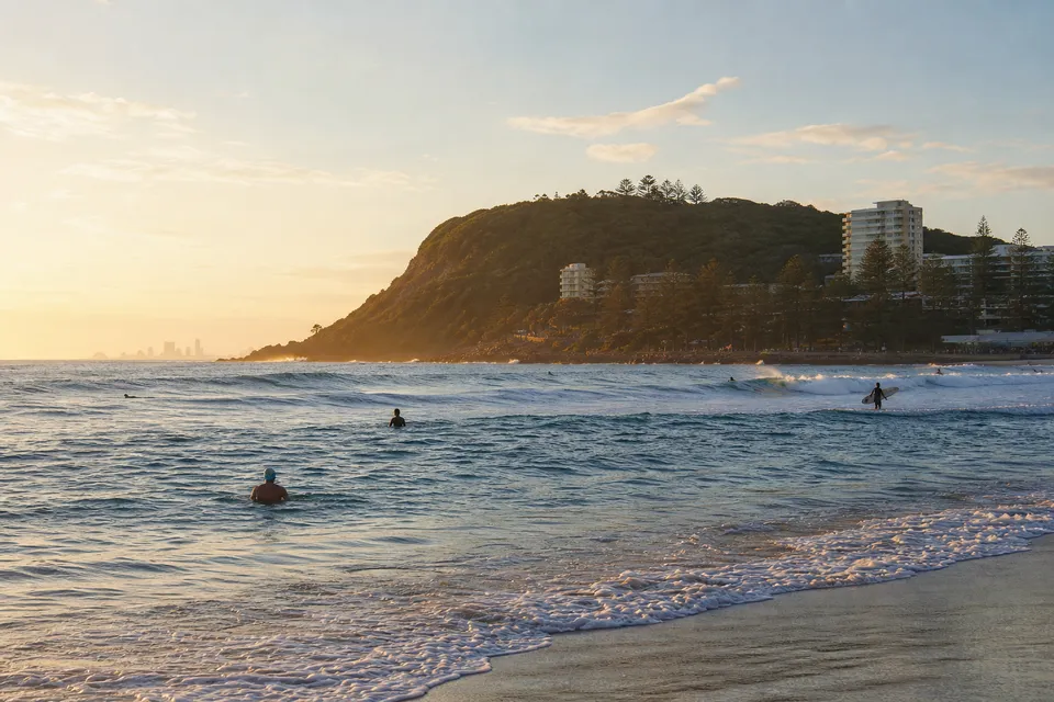
Burleigh Heads expresses a different relationship with the ocean. Its headland creates a strong meeting point between land and sea. People can watch wave conditions from above, walk through coastal vegetation or gather near the beach. The place feels tied to its natural shape as much as to the buildings around it.
These districts should not be treated as copies of each other. Surfers Paradise carries the energy of a dense visitor and entertainment centre. Burleigh Heads has its own headland setting and local beach culture. Their differences show how one coastline can produce several identities.
Surfing also gives residents a shared way to read weather and water. Wind direction, swell and tides can change a familiar beach from one day to the next. A location known for waves may be unsuitable for a beginner at a certain time. Another section may work better because it has different exposure or shelter.
Swimming and surfing are separate uses of the ocean. A surf break can attract experienced riders while nearby currents create risk for swimmers. Beach flags mark areas watched by lifesavers, and local signs warn about known hazards. A famous surf location is not automatic proof of safe swimming.
The deeper point is that surf culture grew from regular contact with the Pacific. Place names and tourism campaigns made that culture highly visible, but its base is physical. Waves meet a long, varied shore, and each part responds differently. Watching the water and reading the beach signs gives a clearer view of Gold Coast culture than treating the coast as a fixed holiday backdrop.
5. Why is there rainforest behind a city known for beaches?
The Gold Coast extends inland from a flat coastal plain to a high, forested hinterland. Rainforest, steep slopes and protected natural areas sit behind the dense urban strip. This is the sharpest contrast within the region.
The change in terrain explains why the inland view looks so different from the beachfront. Near the ocean, development spreads across lower land and follows major roads. Farther inland, the ground rises. Forested ridges replace the straight lines of towers and canal estates.
This hinterland belongs to the Gold Coast’s geography, even though it rarely appears in the city’s best-known images. Rainforest supports dense layers of plant life and responds to a wetter, cooler setting than an exposed beach. Elevated areas can receive cloud, mist or rain while the coastal plain below has different conditions.
The ranges also form part of the wider water system. Rain falling on higher ground moves through creeks and catchments towards the lowlands and coast. This links the fifth fact with the third: the Gold Coast’s waterways do not begin at the canal estates or Broadwater. They connect urban areas with land farther inland.
The hinterland corrects another common misunderstanding. Coastal towers do not mark the full depth of the region. Behind them sits a landscape where steep ground limits dense construction and protected areas retain native forest. The Gold Coast can shift from busy roads to enclosed green slopes within the same broad destination.
That contrast also changes the scale of the city. From the beach, the skyline may appear to be the defining feature. From higher inland ground, the urban strip becomes a narrow band between forest and ocean. Both views are accurate, but neither tells the full story alone.
Use one map that shows the Pacific coast, the Broadwater and the hinterland together. It will reveal the Gold Coast’s defining fact: a large city occupies the narrow meeting place between open ocean, complex waterways and rainforest-covered ranges.